Battle For Okinawa: World War II | home
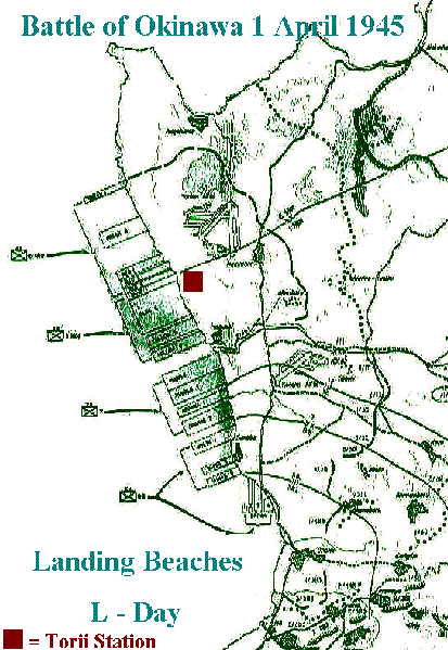
The Landing Areas of Okinawa 1974; A retrospective
 Torii Beach; Sobe Okinawa - Yomitan Pennisula 1974
Torii Draw; and a break in the seawall where the first wave of Marines landed on Okinawa; shore resistance was considered light. However; Allied Forces pummeled Okinawa for 30 days and 30 nights with more ships and bombs than were involved in all of D-Day. US Forces cut the island in-two here at Torii; then moved North and South. Unlike all the other Pacific Islands the Japanese had adopted a plan to hold the high ground and fight a delaying action a portend as to what would come if the US invaded Japan
|
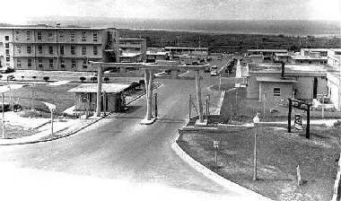
Field Station Sobe; better known as Torii Station
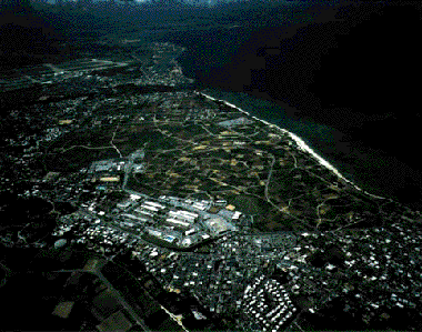
Torii sits atop the World War II landing area of the 1st Marine Division
The Japanese Torii's or Gates were given to the base to promote
peace between the Okinawans and the Americans
(Photo from the roof of the Royal Restaurant Dave Lovelace Photo)
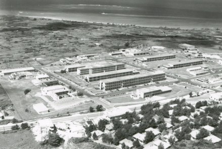
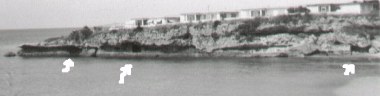
Torii Station positioned on the landing area
Between the main base and the ocean is an extensive
antenna field where local farmers were allowed to grow crops.
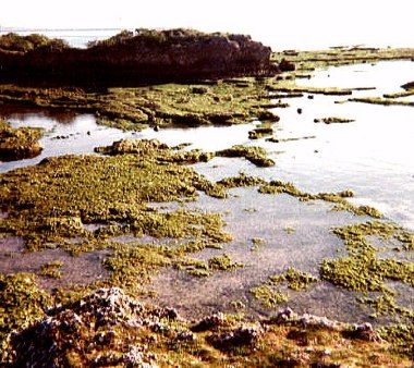
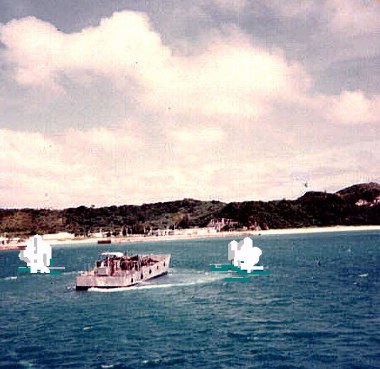
Note: The ' Great Circle Reef ' and the boat passing in between
the shoreline and the reef here at mid-tide.
 (10)
(10) (6)
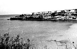
(6)Landing Beach for L-Day Invasion
Top Center is the river; running down the coast line to the right
would be Yellow Beach, then Blue the Red Beach
Buildings in the Center left ; Torii Station. Square at bottom
is either a new housing area since I was there or fuel storage.
Far left in the picture is Yomitan; the Japanese Airstrip
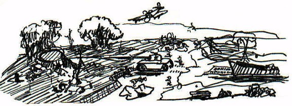
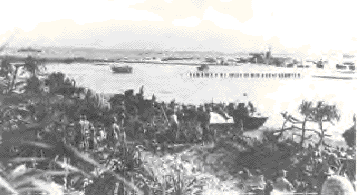
The Battles for Pacific Islands were historic and this is the kind of action expected on Okinawa

Torii Station - Sobe Village Beachhead
A. Inching towards Kadena and a river outlet;
designated Yellow Beaches 1st Marine Division
B. Torii Beach Area with tank traps; Torii Station US Army base
is the group of white buildings far left.
Blue Beach designation
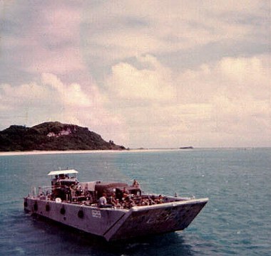
C. Note: Trawler just right of 'B' this area is where many
servicemen drowned during the operation. This is The
'Great Circle Reef'; the landing craft came in at high-tide
they deposited some troops in this area. The coral bed
can clearly be seen here at mid-tide and the water depth drops off
drastically, at least enough to allow passage of a fishing trawler.
D. Sobe Village pockmarked beachhead littered with pillboxes
Red Beach areas 6th Marines
E. Easing North up the Yomitan Coast line the good beachhead continues
then becomes lined with insurmountable cliffs
Red Beach 6th Marines
Rock and A Hard-Place
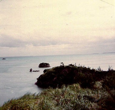
US Forces were caught between a Rock and a Hard Place; Literally.
At High-Tide a broad landing beach for Amphibious Forces couldn't be found.
The Coral Reef line is visible to the left in discolored water before the boat.
This required that the Allies spend extensive time to soften the beachhead
before any landing; unknown to them the Japanese had pulled back into
the hills and the high-ground; Blue Beach
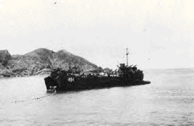
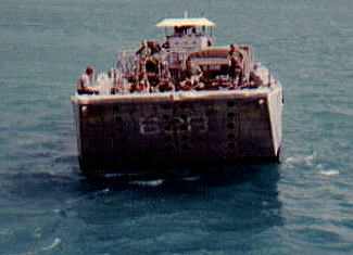
LST 494 in the Pacific Theater
Low-Tide A Blessing and Curse
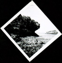
Low Tide or High Tide Protection
Here is a rock outcropping at high tide
If soldiers or marines could get ashore and
traverse the 1/4 to 1/2 mile open exposure they
might be safe enough behind these cliffs.
Fortunately there was little resistance at the initial landing
At Low-Tide the Forces were exposed for quite a distance
Extremely sharp volcanic rock and Coral
One can only imagine having to make progress under-fire
across these coral rocks. Strap on a full pack, grab an M -1 Garand
and try getting over these outcroppings on the double. The pools you see
between the rocks ran to 3 feet in depth or more and that green stuff
was like stepping on a slip and slide; go down there one time and you
and your shoes were cut to pieces
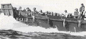
Higgins Boat Underway
"Andrew Higgins is the man who won the war for us. If Higgins had not designed and built those LCVPs, we never could have landed over an open beach. The whole strategy of the war would have been different."
- General Dwight David Eisenhower
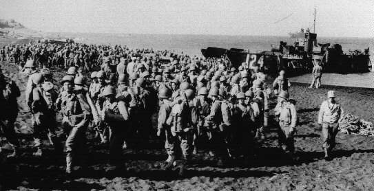
Marines 'wander ashore' on L-Day Hagashi Beach; unopposed. (US Navy Photo)
Modern Marine Landing Craft Making a Run to the Beachhead
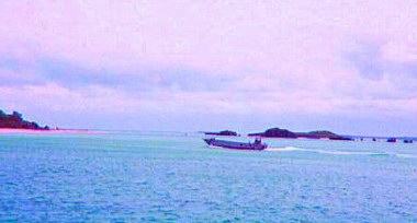
History repeats itself through training
Amphibious Operations on Okinawa 1974. Marine Quick Re-Action
Forces training for Combat Operations near White-Beach.
White Beach is on the East side of Okinawa.
The job of the landing craft is to get in and get out quickly.
Note the exposed operator at the wheel.
Things haven't changed that much
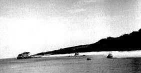
Japanese Range Finding
The explosions in the water are mine; but this will give you an
idea of how exposed landing craft were to enemy fire as they would
come within artillery range. The 2nd Marines made a feint landing
on the Southeast side of the island to draw the enemies attention.
Most beach guns were preset just waiting for a sitting duck or
a landing craft to approach their grid. Any confusion on the part
of operators or hesitation could result in the very last decisions
the boat skipper would make. You can see how a well placed artillery round
amidship would be disastrous for the entire crew and their passengers.
These landing craft operators were some of the bravest men of the war;
returning time and time again to bring troops and much needed resupply;
and ferry out the wounded to waiting hospital ships.
If this were the 'Real Deal'...
That sailor wouldn't be sitting up there...
and everyone would be behind the gunwales
helmets on; gun at the ready; waiting for that door to drop!
Japanese Pillbox Overlooking Torii Beach and Sobe Bay
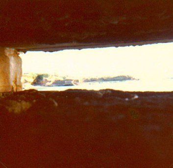
The Last View of Life
There is little doubt that this was probably the last view any Japanese
soldiers had of life if this pillbox was occupied when US Marines came
ashore at Torii and Sobe. Looking through the gun-hole you can see a 'cave'
directly across the bay. This also had been a gun emplacement and another is
vaguely visible across the water at the shore line behind. The Japanese made
good use of natural caves, and weather eaten territory to buildup their shore
defenses; note the 'field of fire' available to machine-gunners who could command
the beach in a strategic hail of crossfire along Blue Beach
Japanese Gun Positions south end Sobe Bay
Controlling Fields of Fire
Gun emplacements above the waterline at High-Tide
the Gun position at the far left in this photo is the pillbox
from which the earlier photo was taken. That position opened on
the opposite side of this cliff and covered both directions. The bunkers were
built using re-enforced concrete; and re-bar to include railroad tracks.
It is obvious that the Japanese had planned to fight on the beach;
but, instead fought a holding action to give the Imperial Empire time.
This is just about the area which divided the 1st and 6th Marines
Same Photo From a Distance
Notice the Gun Ports Disappeared
and were probably hidden from aerial photos
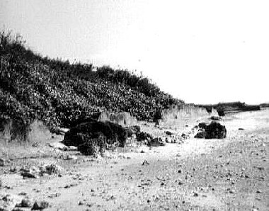
Low-Tide; and lots of real estate shows-up
at High-tide the water smacks the dark areas
where there were barbed-wire entanglements
seawalls and tank traps just for starters. Here
at Low-Tide there's open beaches.
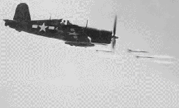
Extensive close air support on L - Day;
using carrier based Corsairs to knock out
pockets of resistance.
(National Archives Photo Used with Permission)
Red Beach - Marines of the 6th Marines come ashore
1 April 1945 on L-Day
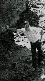
Low Tide - High Water Mark
View from atop Sobe cliffs at Low -Tide.
My hand is placed on the High-tide mark and I stand about 5' 10".
With full gear troops would have found progress
nearly impossible during High -Tide; to get
off the beach they would have been pushed into areas
covered extensively by machine guns and cannons.
The fact that the pillboxes remain; speaks for their
strategic value and their ability to survive massive bombardment.
Tank Traps and Seawalls along The Beach
Tank Traps and Barbed Wire
Once out of the water in areas which were not defended by
Pillboxes; US Forces were confronted by man-made obstacles.
Above a bullet and bomb riddled seawall protects the shoreline.
Dark heaps in the foreground are giant rolls of Japanese Barbed-Wire
Rusting away amidst spent rounds of ammunitions buried along the beach.
Looking towards Yellow Beach
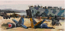
Ordinance on Torii Beach
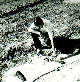
Two Without Explosive Charges
Competition with beer-cans
One with the charge still in place minus the fuse
and another full of ruined explosive material.
The one at the right appears to be Japanese in origin
the brass ring around the large round to the left clearly
is marked 1944: USA...and was probably a 105 howitzer round
Just a little present from Uncle Sam.
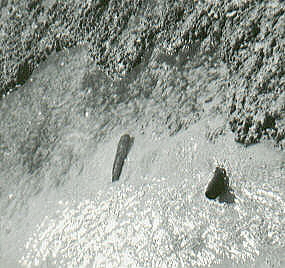
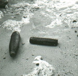
Couple of more rounds lay in the water just off shore
Probably Japanese Artillery Rounds.
Short walks on the beach turned up insignia
shrapnel, (both American and Japanese), small arms rounds
and shell casings. .37mm spent rounds, Japanese mortar rounds
and finned rockets fired by the US Fleet; and a dog-tag.
Even in 1974; approximately two to three individuals on Okinawa were
losing their lives due to WW II Ammunitions every year.
Caves just off the beach
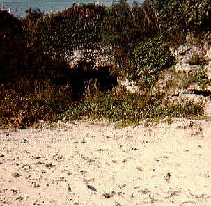
Around every corner and in every ravine are natural Caves
The Japanese Soldier was the master of using natural cover
to his advantage. Here; a cave is exposed just around a bend
on the Beachhead. Caves dot Okinawa which was formed by
Volcanic action. Some of these tunnels stretched for miles. At
Machinato near Kadena Air-base; one cave is reported to have
been used as an underground supply depot and ran all the way to the
Ocean. Military dependents curious of the war would turn-up with cases
of live Japanese grenades and boxes of Ammunition. Somewhere
on the island is reported an underground motor-pool with vehicles intact;
it is said that it was so booby-trapped that US Forces simply covered it up
sealing the Japanese Soldiers and their vehicles for eternity. I could never find it.
The Jungle: A Hostile World
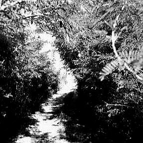
Dense Jungle and Dusty Trails
There are few worlds as unforgiving as a Jungle.
Above; a well used jeep trail parallels the beach.
Most of the vegetation on the landing area was
stripped clean by continued bombing and shelling.
But; inland it was a different story. How thick is this jungle?
I was wearing a white ball-cap; white shirt, shorts and tennis shoes;
I stepped three feet off this path when an Army patrol came by
and no-one spotted me even though they looked in my direction.
Have More information on Okinawa or you'd like to contact us: